Mississippi Delta at risk of severe storms on Wednesday with tornadoes possible
The area just west of the Mississippi river in the Mississippi delta is most at risk for severe weather on Wednesday.
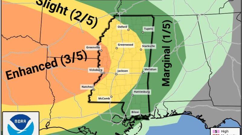
From the Mississippi Weather Network:
SEVERE WEATHER OUTLOOK: We are tracking a mild threat for severe weather during your overnight hours. This threat will mainly consist of straight line winds and hail, but a SPIN-UP tornado or two will be possible.
The NWS Storm Prediction Center has the extreme WEST CENTRAL areas of Mississippi under an enhanced (level 3/5) risk area, while the majority of the state will remain under a slight (level 2/5) risk for severe weather. This threat will start in the west side of our state around the 6:00 PM hour today and will exit the Southeastern portion of Mississippi by 10:00 AM on Thursday.
On top of the threat for severe wind gust there is also a threat for strong, but non-severe winds associated with this storm system. There is a flash flood watch currently in effect for most counties along and to the north of Interstate 20 due to the possibility of 2-4 inches of rain being possible overnight as this system progresses through the state. Our team will keep you up to date with any changes this forecast may have, as model runs have been a little jumpy on this possible event.
Please go ahead and take a moment to dust off your severe weather plans once again