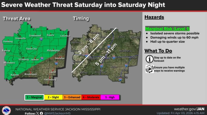
Severe Weather Outlook Focuses on Highest-Risk Areas North and West of Natchez Trace
The National Weather Service issued an updated severe weather outlook this morning, refining the marginal risk zone to focus on areas with the highest likelihood of isolated severe storms.
The revised forecast indicates that the most significant threat is concentrated mainly north and west of the Natchez Trace. Meteorologists emphasize that the area now identified has increased confidence in severe weather development.
Officials urge residents in the affected regions to stay alert and monitor local weather alerts throughout the day. No widespread severe weather is expected, but isolated storms could produce damaging winds and hail.
The update aims to help communities better prepare and respond to potential severe weather threats today.
Source: Original Article