Severe weather forecast for Southeast Arkansas and North Mississippi through midweek
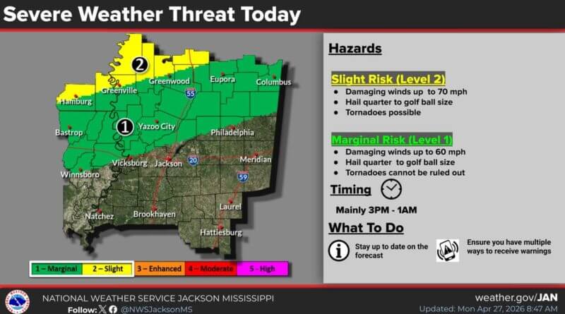
More storms are expected to hit the area, with the most widespread activity forecast for Tuesday, the National Weather Service in Jackson, Mississippi, said. Damaging winds are the main hazard through midweek, but hail and isolated tornadoes are also possible.
Isolated strong to severe storms are predicted to move across Southeast Arkansas and North Mississippi late Tuesday afternoon into Tuesday night. The threats include damaging winds up to 70 mph and hail between quarter- and golf-ball-sized. A few tornadoes cannot be ruled out, the agency warned.
On Tuesday, thunderstorms are expected to diminish early Wednesday morning after moving across the region. Heavy rainfall of 2 to 4 inches may occur in parts of Southeast Arkansas and North Mississippi during Tuesday night.
By Wednesday afternoon, showers and isolated strong to marginally severe storms could redevelop behind the morning activity. These storms are expected to weaken by evening, the weather service said.
Source: Original Article