Severe Storms Expected in Mississippi Area Today, NWS Warns
Severe thunderstorms are forecast to move across portions of Mississippi beginning this afternoon, according to the National Weather Service in Jackson.
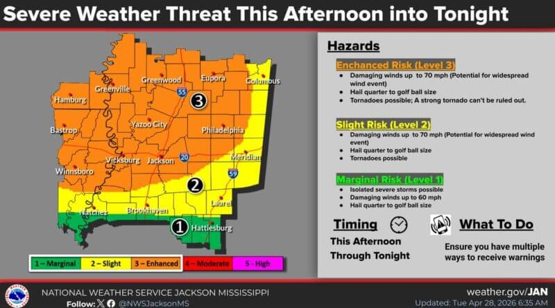
The primary hazards include damaging winds with gusts reaching up to 70 mph, along with the potential for tornadoes. The NWS indicated a possible widespread damaging wind event and noted that a strong tornado cannot be ruled out within the enhanced risk areas.
Large hail—ranging from quarter-sized to golf ball-sized—may also occur across the region. By this evening, locally heavy rainfall is expected, especially in central and northern areas. Most locations within the limited risk zone could see 1 to 2 inches of rain, with some areas experiencing 3 to 6 inches in a short period due to training storms, which could lead to localized flash flooding in low-lying and urban areas.
On Wednesday afternoon, scattered showers and isolated storms capable of producing large hail and damaging winds are forecast to develop across parts of the area. These storms are expected to diminish by evening, the NWS added.
Source: Original Article