Severe Storms, Cold Snap Threaten Mississippi Area
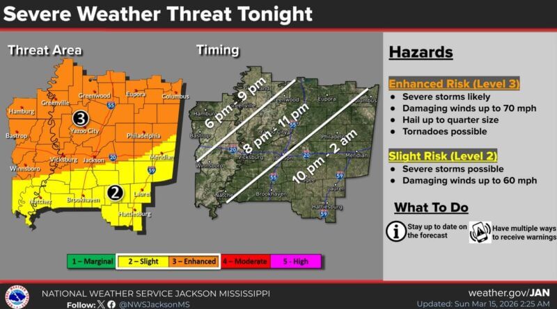
A line of severe storms capable of producing damaging wind gusts, tornadoes, and hail up to quarter size is expected to move across the Mississippi area tonight, according to the National Weather Service in Jackson.
Ahead of the storms, strong and gusty southerly winds will develop today. These winds are expected to persist into Monday night and Tuesday morning behind the storm system, the NWS said.
The weather service advises residents to stay weather-aware later today and to have a plan of action ready in case severe weather approaches their location. Following the storms, forecasters are predicting record-cold conditions for this time of year, with a hard freeze likely across much of the region.
This cold snap could significantly impact unprotected vegetation, especially as the growing season is already underway, the NWS warned.
Source: Original Article