Satellite imagery reveals snow and ice boundaries and transitions
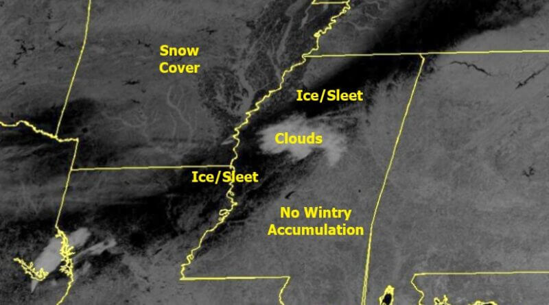
Satellite imagery this morning revealed not only the boundary between areas with and without snow accumulation but also the transition between ice and snow on the ground, according to NOAA officials.
NOAA satellites capture images across multiple spectral bands, providing detailed views of different environmental features. One such band, the 1.6-micrometer near-infrared, known as the “Snow/Ice Band,” typically helps distinguish water from ice clouds.
Officials said this band is also useful for differentiating between snow and ice on the ground, offering valuable information for weather and climate analysis.
The imagery offers a clearer picture of the varying conditions across the region, aiding meteorologists and researchers in understanding the current snow and ice distributions.
Source: Original Article