Ice Storm Warning Expanded in Mississippi as Cold Front Approaches
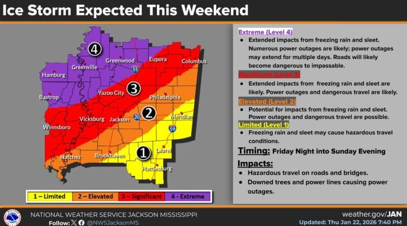
The National Weather Service in Jackson, Mississippi, has expanded its ice storm warning to include Grenada, Webster, Montgomery, Carroll, Holmes, and Yazoo counties, according to a recent update.
Areas highlighted in purple on the agency’s map are expected to experience the longest duration of freezing rain and sleet, with total accumulations exceeding an inch. The timing of colder air moving into the region has shifted later, likely reducing impacts during the day Saturday.
Freezing rain is forecast to begin after 6 p.m. Saturday in areas south of Yazoo City, including the Jackson metro area. Further south, toward the Pine Belt, the onset is expected to be delayed until overnight Saturday into Sunday morning. Officials noted that recent guidance suggests the cold air could arrive even later in these areas.
Despite the delayed start, dangerous cold temperatures are still expected following the winter storm. The National Weather Service has not issued any updates regarding those conditions at this time.
Source: Original Article